The Jim Monini Photos
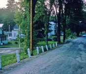
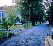
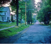
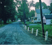
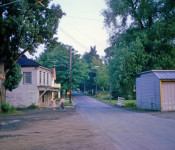
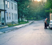
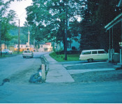
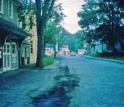
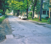
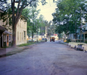
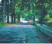
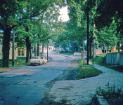
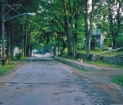
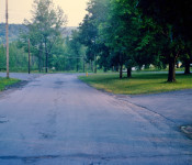
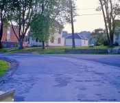
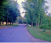
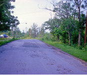
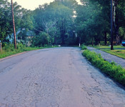
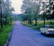
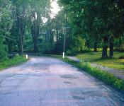
The photos in the following photo gallery were taken by Mr. Vincent James “Jim” Monini during the summer of 1963 in anticipation of a new road to be built through Delanson. The new road would basically follow the old road with with some additions and would be called Route 395. The new road would dramatically change the appearance of the Village of Delanson.
There was much opposition to the new road. The beautiful big trees that lined the old road were to be taken down, the road widened with shoulders and gutters along the road with frontage of homes taken and buildings taken down or moved to accomplish this. Besides defacing the village, the people thought it would be a speedway. Turns out they were right.

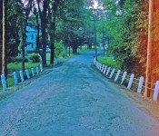
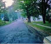
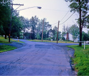
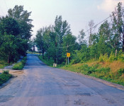
Entering the Village in 1963 from Quaker Street looking North
These photos provide a historic look at the Village before 395 was constructed in 1964. Mr. Monini passed away in 1984 but his photos live on for all to enjoy.
Thank you to Vince and Dale Monini for allowing their father’s slides to be copied and shared by all. Thanks to Mr. Al Zubal for providing these photos to the village for use on our website and Lenny & Pat VanBuren for use of their 1964 Delanson Roadway Improvement Program notes.
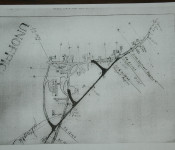
The first photo is the proposed location of the new route 395. It clearly shows that the new road would bypass the Duanesburg H.S.. Note the old road behind the High School.
Please click on any photo to see a larger view. Enjoy!
Map of proposed 395 around Duanesburg HS. Notice there was also a road behind the HS.
Entering the Village from Quaker Street looking north toward East and West Shore Rd.
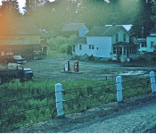
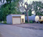
Looking west from 395 at Canastra's Garage. Currently the Risley property.
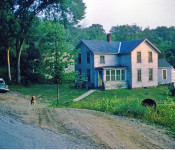
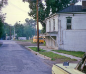
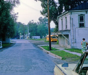
Looking southwest from 395 at Lottie Bradt's house and the Youngs house rented by Harold Bradt in the background
Further north on 395 you can see the front of the Risley property. Notice it is almost level with the road.
Looking North towards the corner of East and West Shore Rds
Corner of West Shore Rd and Main Street
Corner of East Shore Road and Main Street. Phone company and Methodist Church parsonage on right.
East Shore Road and Main Street - Drinion Home/ Town Clerk office currently the Mackie home
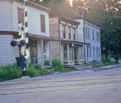
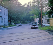
Looking North on Main towards the railroad tracks
Old English's Market which was straddling the Normans Kill creek next to the Post Office.
Village resident Helen Zubal (on right) and friend. The bus garage in the background.
Looking south on Main Street - English's market on left and Edward' Oil Company on right. Notice the creek that goes under 395 behind the oil company.
Looking south on Main at Edward's Oil Company
Looking north over the RR tracks, the Shoudy House, Dobert’s Store and Former Central House Hotel
Looking North on Main, Florence Jackson’s on the Right which is currently located where the addition to the fire house is and parking lot.
Red VanderWerker, Water Commissioner on right. Former central house on left.
Looking South on Main Street, Carroll’s Store and the old Post Office across from the fire house.
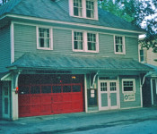
Fire House, Jenny Robinson’s Home (currently the addition to the fire house) and Florence Jackson’s
Fire House, Jenny Robinson’s Home (currently the addition to the fire house) and Florence Jackson’s. Imagine having a tree just outside your front door!
The Fire House as it looked in 1963.
Looking north with back to Thousand Acre Road - White Funeral Home, Shafer Home, Meyers’ Home
Looking South on Main Street, the White VanBuren Funeral Home on the left and the RR tracks in the background with Thousand Acre Rd on right.
Looking South, Meyers, Shafer’s and White VanBuren Funeral Home
Looking south on Main Street standing by the creek next to O'Connor property.
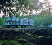
Grenier’s Home Being Moved. It currently sits behind the pines near the Duanesburg H.S
Starting up School Drive, Barber Shop on right opposite the Duanesburg H.S.
School Drive with school on left.
Looking south on School Drive, the HS is on the right and the barber shop is on the left. Not much has changed here.
Looking up (west) Fairview Ave. (currently Alexander Rd.)
On Fairview Ave (currently Alexander Rd.), looking west, road behind school in on left.comes in on left.
Looking down (east) on Fairview Ave (currently Alexander Rd.) to where the new 395 would connect. Dutcher home in the backround.
Looking South on Main Street below High School
Looking South on Main Street Grenier’s on Right. House was moved back for new road.
On Main Street, looking south, Grenier’s on right, Edwards’ (currently O'Connor's) straight ahead.
During the road construction, three homes and one business were moved:
- Grenier’s was moved farther back on their land.
- Dutcher’s was moved over to Stewart Drive,
- Ullman’s rental house-trailer was moved away, and
- Edward’s Coal and Oil business moved to 1000 Acre Road, including the garage/office building and the oil tanks.
Nine houses were taken down:
- Lottie Bradt’s (Jake Bradt’s mother) house at the foot of Quaker Street hill
- Next house Owned by Young’s rented by Harold Bradt’s family before they relocated down the street
- English’s Market with apartment upstairs – the building straddled the Normanskill Creek
- The Shoudy House that sat on the northwest corner beside the RR tracks, which had been converted to two apartments
- Dobert’s Store – right next door, with William Lyons Law office upstairs, accessible by and outside staircase
- Central House Hotel which had been converted to four apartments
- Deming Home Just before Cole Road, across from Reta Smith’s
- Wm. Lyons rental house on the curve by Cole Road
- Resue home – next door [?]
The next year they finished the road to Route 20. Raising the road in many areas and by the reservoir doing away with the wet area of the reservoir on the west side of the road.
The village drained the reservoir at this time and the road contractor dug it out using the topsoil for the road project.